
For decades, the most volatile arena of India–Pakistan tensions has been the northern frontier — the Line of Control in Jammu & Kashmir and the Pakistan-occupied Kashmir (PoK) region. But the geography of this rivalry appears to be shifting southward.
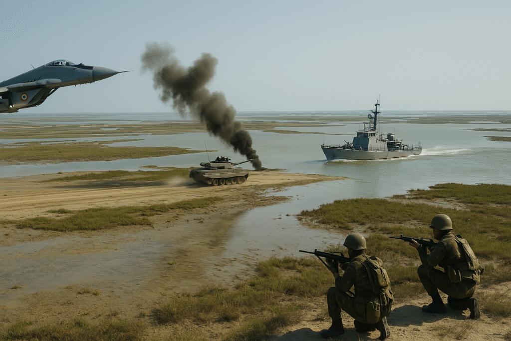
The Indian Armed Forces’ tri-service exercise “Trishul”, now underway along the western front with Pakistan, has brought renewed focus on Sir Creek — a narrow, marshy estuary between Gujarat and Pakistan’s Sindh province. Once a peripheral issue in the bilateral conflict, Sir Creek is fast becoming a new frontier of strategic contention.
India’s Exercise and Pakistan’s Countermove
The Trishul exercise, being conducted from October 30 to November 10, has prompted India to issue a Notice to Airmen (NOTAM) over the Rajasthan-Gujarat border region. Pakistan quickly followed with its own airspace restrictions — possibly for a simultaneous military drill or missile test — covering large parts of its central and southern airspace.
Though Indian military officials describe Trishul as a “routine annual exercise,” its timing, scale, and focus on Sir Creek send a clear signal. The joint participation of the Army, Navy, and Air Force indicates preparation for both offensive and defensive operations, highlighting India’s readiness against any maritime incursions.
Defence Minister Rajnath Singh’s recent warning to Pakistan underlined the region’s growing importance, declaring that any aggression from across the creek “will be met with a resounding response that will change both history and geography.” His statement that “one route to Karachi passes through the creek” further emphasized India’s military confidence in the sector.
Why Sir Creek Matters
Sir Creek stretches 96 kilometres, separating the Rann of Kutch in Gujarat from Sindh in Pakistan. Despite its barren terrain, the area holds immense geopolitical and economic value. The precise demarcation of this boundary determines the starting point of the two countries’ Exclusive Economic Zones (EEZs) — which extend 370 km into the Arabian Sea and encompass rich fishing grounds and possible oil and gas reserves.
India bases its claim on a 1914 British-era resolution supporting a midstream boundary, while Pakistan asserts the eastern bank as the dividing line, which would give it control of the entire creek. Despite a dozen rounds of talks since 1969, the dispute remains unresolved.
Rising Strategic Significance
Once neglected, the creek has gained attention following increased reports of abandoned boats — believed to have drifted from Pakistan — and the expansion of Pakistani military infrastructure nearby. The Southern Command of the Indian Armed Forces has now integrated the region more closely into its coastal defence grid, especially after Operation Sindoor.
Sir Creek’s location makes it strategically vital, lying close to India’s naval and energy installations along the western coast. Analysts warn that Pakistan might attempt to provoke limited maritime incursions or infiltration operations here as it faces growing instability at home and tighter Indian surveillance in northern zones.
The New Frontier of Deterrence
By conducting Trishul near Sir Creek, India has sent an unmistakable message: its threat perception now extends beyond the Himalayas to the Arabian Sea. As India fortifies this frontier and Pakistan tests its defences, Sir Creek could become the next nerve centre of India–Pakistan tensions — where deterrence, diplomacy, and geography converge in a high-stakes contest.
Originally published on newsworldstime.com.
Originally published on 24×7-news.com.