
The world’s most expensive Earth-observation satellite, NISAR (NASA-ISRO Synthetic Aperture Radar), has officially begun its scientific mission, delivering its first ultra-sharp look at India. The image marks a major milestone for the $1.5-billion India–US collaboration, which aims to transform global environmental monitoring.
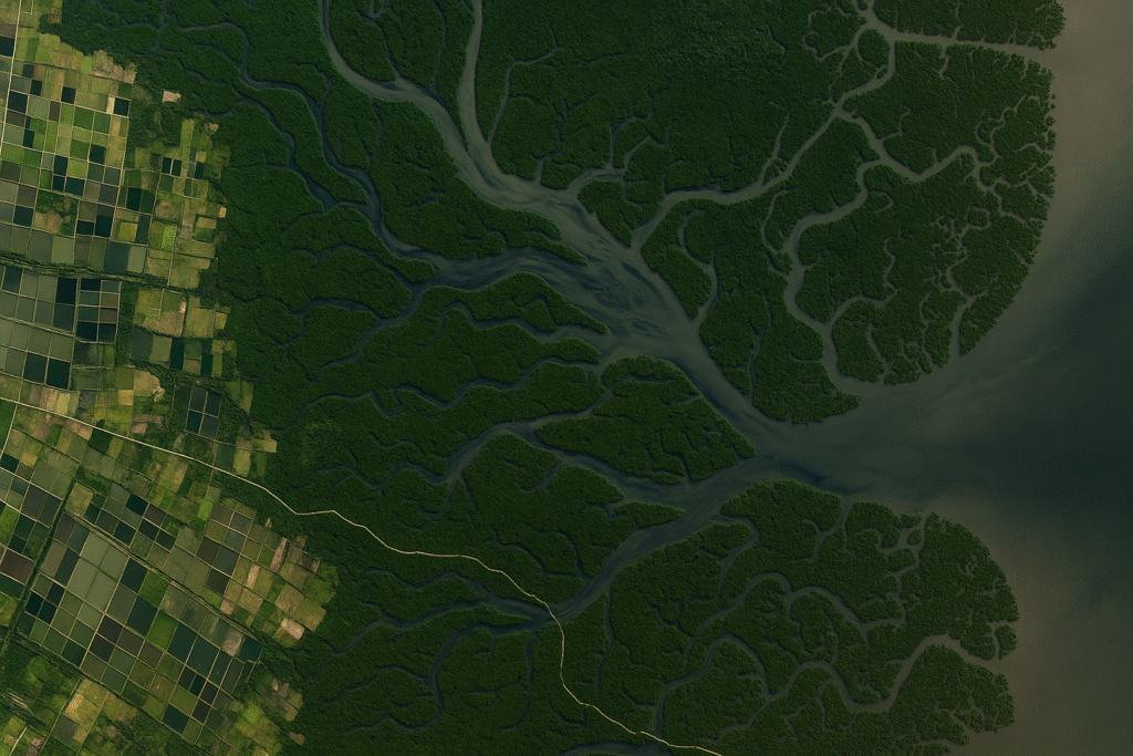
📸 First Image Highlights Godavari River Delta
NISAR’s S-band radar captured a remarkably detailed view of the Godavari River Delta in Andhra Pradesh, revealing mangrove forests, agricultural fields, aquaculture ponds, and arecanut plantations.
ISRO released the image as NISAR completed 100 days in orbit since its launch aboard GSLV-F16 on July 30, 2025.
The image showcases the satellite’s ability to penetrate clouds and darkness — giving India round-the-clock environmental insight.
🛰 Why Was Deployment So Complex?
NISAR carries:
- NASA’s largest-ever spaceborne reflector — 12 metres wide
- Mounted on a 9-metre deployable boom
- A sophisticated joint system with wrist, shoulder, elbow & root mechanisms
Between August 9–15, ISRO (ISTRAC, Bengaluru) and NASA (JPL) teams coordinated the delicate unfolding sequence.
Multiple checks confirmed the L-band and S-band radars were operating flawlessly, allowing the mission to move toward full science operations.
📡 Proven Imaging Precision
The satellite began calibration scans from August 19, recording:
- Test sites across India
- Corner reflectors near Ahmedabad for pointing accuracy
- Amazon rainforest passes to verify global imaging consistency
These tests validated NISAR’s capability in:
- Agriculture monitoring
- Hydrology
- Forestry
- Geoscience mapping
- Himalayan ice shift tracking
Its ability to capture images overnight or through clouds gives India a major advantage during monsoons, floods and cyclones.
🌍 A New Era of Earth Monitoring
Orbiting at 747 km in a sun-synchronous path, NISAR will map the entire land and ice surfaces every 12 days.
The satellite can detect tiny ground movements, enabling early warnings for:
- Earthquakes
- Landslides
- Glacier changes
- Riverbank shifts
- Coastal erosion
- Crop stress
With climate pressures rising globally, NISAR’s real-time radar data will play a vital role in environmental planning and disaster preparedness.
The start of its science phase signals the beginning of a long, transformative period of observation for India and the world.
Originally published on 24×7-news.com.