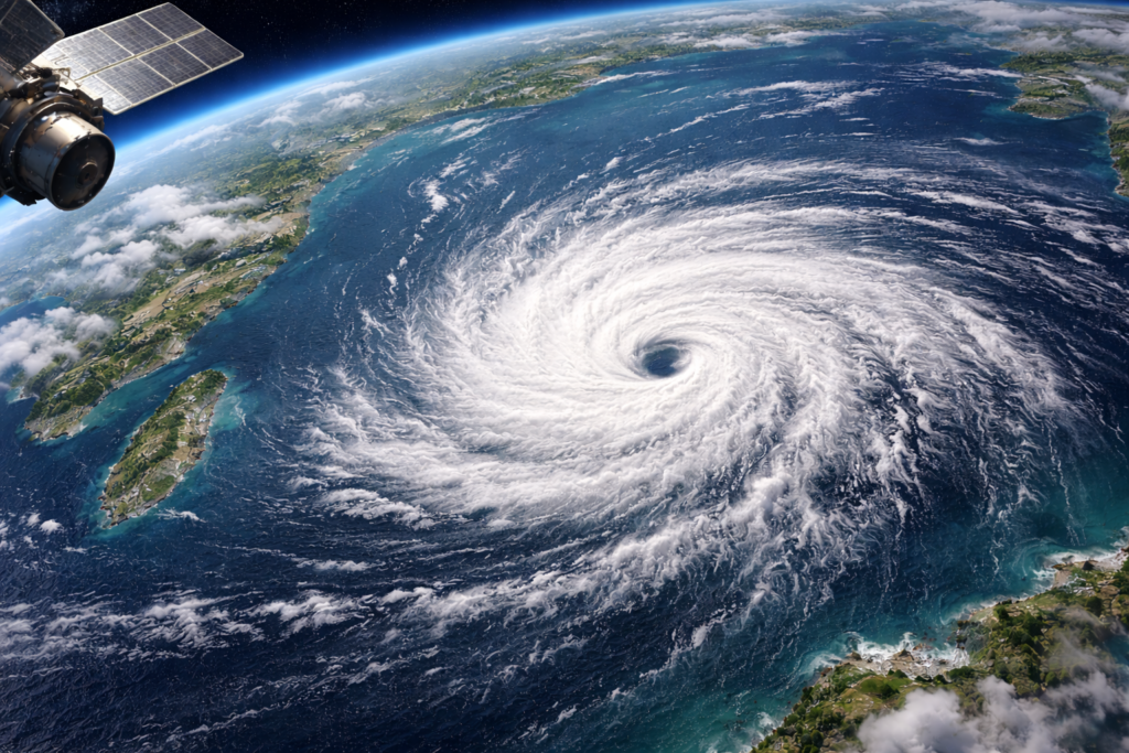
Tropical Cyclone Horacio has intensified into a powerful Category 5 storm in the South Indian Ocean, becoming the strongest cyclone recorded globally so far in 2026.
Satellite imagery captured on February 24 revealed the rapid formation of a well-defined eye at the centre of the storm — a classic indicator of extreme intensity. Sustained wind speeds reached approximately 257 kmph, strong enough to cause widespread structural damage if the system were to make landfall.
How Did Horacio Strengthen So Quickly?
The cyclone developed east of Madagascar and underwent rapid intensification within a short span of time. Meteorologists reported that wind speeds surged dramatically in less than 24 hours.
The primary driver behind this explosive growth was unusually warm ocean waters exceeding 28°C. Warm sea surfaces act as fuel for tropical cyclones, supplying the heat energy needed to strengthen storm circulation.
European satellite monitoring agencies and disaster response teams confirmed that this warm ocean patch played a critical role in Horacio’s rapid intensification.
Is India in Danger?
Despite its strength, Cyclone Horacio is currently located far from India and other populated regions. Weather experts confirm that the system is not tracking toward India, Mauritius, or nearby coastlines.
Instead, the cyclone is moving southward into cooler waters, which typically weaken tropical systems. As it travels over lower sea-surface temperatures, it is already beginning to lose some intensity.
Indian meteorological agencies continue to monitor the storm using advanced satellite systems, but officials have stated that there is no threat to Indian coastal areas at this time.
Climate Change and Rapid Intensification
While Horacio does not pose an immediate risk, scientists say its rapid strengthening highlights a broader climate concern.
Warmer oceans — driven by rising global temperatures — are increasing the likelihood of rapid cyclone intensification events. Numerous peer-reviewed studies have linked ocean warming to stronger and faster-growing tropical storms worldwide.
Horacio may remain safely over open waters, but its sudden transformation into a Category 5 system serves as a reminder of how climate change is influencing extreme weather patterns.
As global temperatures continue to rise, experts warn that such high-intensity storms could become more frequent, reinforcing the urgency of climate action and sustainable environmental practices.
Originally published on 24×7-news.com.